

A series of errors by the CSIRO has placed the world's largest collection of indigenous rock art at risk.
Subscribe now for unlimited access.
$0/
(min cost $0)
or signup to continue reading
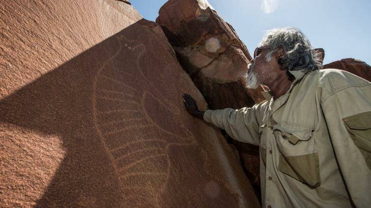
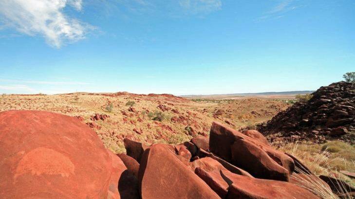
Burrup Peninsula has more than one million rock art engravings over more than 100 square kilometres, some dating back more than 30,000 years. It includes the oldest existing representation of a human face on Earth, images of extinct megafauna and a thylacine, or Tasmanian tiger, which roamed the Pilbara region thousands of years ago.
The area is also the site of some of the biggest natural gas and ammonia fertiliser production facilities in the world. Emissions from this industry, in high enough concentration, have the potential to damage rock art.
A former assistant divisional chief at CSIRO, Dr John Black, has said the organisation's advice to government and industry about safe atmospheric acid levels on the Burrup Peninsula in Western Australia is built on a "house of cards".
A senior museum scientist described the CSIRO's approach as a "fundamental failure of method".
And the author of a report upon which the CSIRO relied to give its advice said the advice was "just plain wrong".
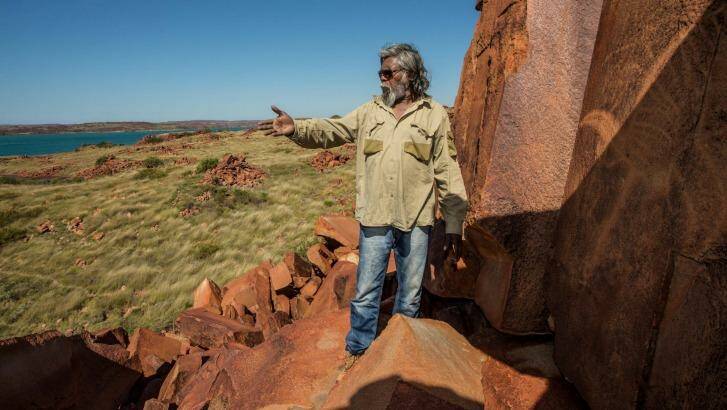
The peninsula, known as Murujuga to the traditional custodians, remains central to the living culture of local Aboriginal people. The site is of such significance to the custodians that Fairfax Media, at their request, has not reproduced images of humans etched into the rocks of Burrup.
Local Wong-Goo-Tt-Oo Aboriginal elder Wilfred Hicks said: "This is a bible that's been left for the Aboriginal people.
"The rock carvings are on the Burrup today to teach people ... Exactly the same as how a priest has to be trained, the Aboriginal people train their children to do exactly what they've been taught."
The CSIRO has been monitoring rock art in the area on behalf of the WA government for more than a decade. The government receives funds from industry on the Burrup for this monitoring and industry has also paid CSIRO directly for monitoring.
The CSIRO said it "is committed to providing the WA Government with robust data to ensure the preservation of the Burrup heritage rock art sites".
However, Johan Kuylenstierna of the Stockholm Environment Institute said the CSIRO was misusing his research to support unsuitable advice about atmospheric acid levels.
Dr Kuylenstierna has written to a Senate inquiry into protection of the rock art to say the use of his research by the CSIRO "to say anything of relevance to the rock art in the Burrup Peninsula is just plain wrong".
He said it cannot be used to justify safe levels of acid emissions recommended by the CSIRO.
Fairfax Media asked the CSIRO to explain the scientific basis for using Dr Kuylenstierna's research to set a critical acid load recommendation for the rocks and rock art.
The CSIRO replied to this question with one line: "At the time of writing [in 2008], [Kuylenstierna's] paper was used as a best approximation to the rock ecosystem at Burrup."
Dr Kuylenstierna has emphatically stated that the report, known as Cinderby et al (1998), has no relevance to understanding the ability of rock art to resist acid deposits on the Burrup.
He also said:
- The report used 1:5,000,000 scale global maps from the UN's Food and Agriculture Organisation, which would not show up the detail of the soil type in an area such as the Burrup;
- The main soil type in the Burrup area differs from the region as a whole;
- The maps are not based on information about the parent material of the soil;
- What is required is a detailed understanding of the particular weathering processes on the rocks faces on to which the rock art is carved.
The CSIRO admitted it had never undertaken any assessment of the capacity of the Burrup rocks to cope with acid deposition from industry.
Without doing such testing it nonetheless advised the WA government and industry that "acid deposition to the Burrup area is unlikely to cause any deleterious effects to rock or rock art on the Burrup peninsula".

All industry groups on the Burrup – including Woodside, Rio Tinto and Yara Pilbara – have cited this CSIRO advice as evidence its emissions are safe.
A spokesman for the CSIRO told Fairfax Media: "We have never studied the buffering capacity of the rocks. This was never a part of the contracted work."
Buffering refers to the capacity of a substance or object to maintain stable pH levels.
Yet, the author of the 2008 CSIRO report upon which advice to industry is based, Rob Gillett, has told Dr Black that such a study is required.

On November 6, 2016, Dr Gillett wrote to Dr Black: "I do share your concern for the future health of the rock art as more industry is added to the area ... I think that detailed study is required to better ascertain the buffering capacity/critical loads."
Yara Pilbara, which operates the ammonia fertiliser plant at the Burrup, is about to start operation of an adjacent ammonium nitrate explosives plant, which it jointly owns with Orica Australia.
Dr Black, who was assistant chief of CSIRO's animal production division until 1996, is concerned that when that plant begins operation this year acid loads will increase.
According to Yara Pilbara's environmental compliance assessment reports, the plant will annually produce 135 tonnes of nitrogen oxides; 164 tonnes of nitrous oxide; 41 tonnes of carbon dioxide; 18 tonnes of methane; 20 tonnes of ammonia; and 25.2 tonnes of dust-sized ammonium nitrate particles. Many of these emissions would increase acid load onto the surrounding rock art.
In 2003 and 2004 Dr Ian MacLeod, who worked as a senior scientist at the WA Museum for 38 years, measured local pH levels. To his knowledge he is the only person who has taken acidic readings of the rocks. He published his findings in a peer-reviewed paper in 2005 for the International Council of Museums committee for conservation.
That study found that "the current microenvironment of the Burrup Peninsula is more acidic than before industrialisation".
Dr MacLeod told Fairfax Media: "For the CSIRO not to test the buffering capacity of the rocks is a fundamental failure of methodology.
"The rock surface is where all the action is. With all respects to the CSIRO, if you don't do this then how are you meant to understand the chemistry of what's going on?"

Dr Black, who is a member of Friends of Australian Rock Art, said the CSIRO has made further errors in its measurement of colour changes to the rock art.
The CSIRO has been doing regular readings of the art since 2004, on behalf of the WA government and Burrup industry groups.
However, Dr Black said colour monitoring has relied on inconsistent statistical methods.
In emails seen by Fairfax Media, CSIRO personnel seem to accept this, saying: "CSIRO reports haven't previously included statistical modelling of colour data over time; its addition will be welcome."
In one email to Dr Black, a CSIRO staff member said: "That the data do support colour change on the Burrup rock art is certainly worth reporting in my view."
However, CSIRO reports on rock art colour on the Burrup have said that no significant changes have been detected. These findings have been cited by industry in their claims that emissions are no threat to the art.
Yara Pilbara told Fairfax Media: "Since monitoring began, there has been no credible scientific evidence to indicate that industrial emissions are having any measurable impact on the rock art."
However, the statistician working on those reports emailed Dr Black on May 16, 2016, to say: "Significant colour change has been recorded in at least some observed spots of rock art on the Burrup peninsula. I absolutely agree that conclusion should be brought out clearly."
However, the CSIRO has made no such report in public.
A CSIRO spokesman said that one of the devices used to measure colour produced "fluctuation in the ... data". He said that due to this fluctuation "and the fact that it contradicts the evidence of [other] machines, the overall conclusion on all the data has been that they don't provide strong evidence that colour change over time has occurred".
The CSIRO said it was preparing a new report and repeated its assertion that there is "no evidence of significant differences in colour change between southern rocks situated near industrial activity and northern rocks situated away from industrial activity".
However, Fairfax Media can also reveal that one device used to monitor rock art colour is designed for indoors use only, but is used outdoors where temperatures can soar above 40 degrees.
The instruction manual for the Konica Minolta CM700-d used by the CSIRO states the device has been "designed exclusively for indoor use ... [and] ... should never be used outdoors".
The CSIRO said: "The Konica Minolta CM700-d was used under sought advice that the specifications around outdoor use are to do with the potential for adverse weather conditions to damage the instrument, not its effectiveness or accuracy outdoors. The instrument was used in the study under ideal outdoor conditions."
Dr Black has taken his concerns to the CSIRO and the West Australian government. He said: "Despite being aware of the comments from the scientific paper's author, the CSIRO scientist has to date refused to change his opinion and retract his conclusion."
Dr Black was been given confidential access to the raw data of colour measurements taken by the CSIRO. He has written his findings and submitted them to the WA government.
However, the government will not release the data or Dr Black's report. Due to the confidentiality agreement, Fairfax Media is unaware of its conclusions.
WA Environment Minister Albert Jacob said: "It would not be appropriate to release the raw data and Dr Black's paper until the peer review process is completed."
The Senate inquiry into protection of the rock art will hold a public hearing on February 17. It is due to report on March 21.
The heart of the scientific dispute
Emissions from industry on the Burrup, particularly from the Yara Pilbara Fertilisers plant, produce nitrogen oxides and other chemicals, which could pose a threat to the rock art.
A report by Rob Gillett at the CSIRO in 2008 cited work by Dr Johan Kuylenstierna and his colleagues that the CSIRO claimed puts the Burrup Peninsula in the "least sensitive class" to the acid emissions.
The Gillett report said: "The critical load for the Burrup area is at least 200 milliequivalents per square metre per year… [of acidic emission].
"Since this is significantly more than the observed deposition fluxes at the sites they are unlikely to cause any deleterious effects to rock or rock art on the Burrup Peninsula."
However, Dr Kuylenstierna has said: "This assertion is incorrect."
Yara Pilbara, in conjunction with Orica Australia, has completed construction of a $700 million ammonia nitrate explosives plant next to its fertiliser plant. From its own reports, the Yara plant will increase the atmospheric load of nitrogen-based oxides and particulate ammonium nitrate.
These can damage rocks when they turn into acids in the environment.
CSIRO-measured levels already place emissions above the limit of the most sensitive class cited in the Kuylenstierna/Cinderby report.
Friends of Australian Rock Art, based in Perth, is campaigning for the site to be reclassified in this most sensitive class, which means acidic emissions of less than 25 milliequivalents per square metre a year.
The CSIRO has told Fairfax: "Research shows small increases from low-level naturally occurring background flux of sulfur and nitrogen of 14 meq/sqm/yr to 20-33 ± 20% meq/sqm/yr at sites close to industry."
Dr Kuylenstierna said that the 200 meq/sqm/year in his research refers to the broad sensitivity of surrounding ecosystems, using maps at a scale of 1:5,000,000. He said this can only show "broad patterns … not local detail".
"But the point is that these are soil maps and not geology maps and so still misses the point – the method is not based on an assessment of the geology," Dr Kuylenstierna said.
He also said that the study refers to the sensitivity of ecosystems, not of the rocks to weathering.
"If anything, the reverse is true, as more rapid weathering of minerals in the soil leads to better buffering and less damage to ecosystems ... the rocks in a highly buffered region would weather faster," he said.
The suggestion that rocks in highly buffered regions would be susceptible to faster weathering was in the original 1998 study cited by the CSIRO in its 2008 report.
Fairfax Media has updated this story to fully reflect Dr John Black's affiliations.

